OpenSR at the 4th IADF School: Luis and César Lead Sessions on EO Super-Resolution

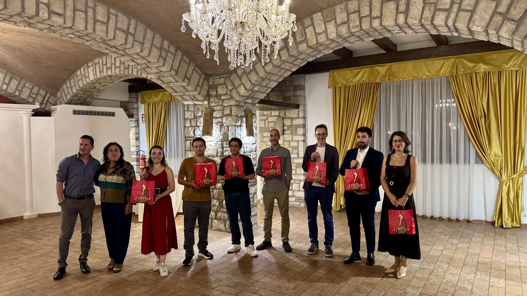
The 4th edition of the IEEE GRSS IADF School took place in Benevento, Italy (16–19 September 2025), bringing together students and researchers for an intensive week of training in computer vision for Earth observation. The program covered a wide range of topics — from super-resolution and self-supervised learning to explainable AI — and continued the school’s tradition of blending rigorous scientific content with a welcoming, community-driven atmosphere.

We’re proud that OpenSR team members Luis Gómez Chova and César Aybar were invited speakers at this year’s event. They delivered a dedicated workshop on trustworthy multispectral super-resolution and explored large-scale EO learning workflows, offering students a practical and transparent look into the challenges and opportunities of modern AI for remote sensing. Their sessions were among the most engaging of the week, sparking great discussions and hands-on exploration.

A huge thank you to the IEEE Geoscience and Remote Sensing Society (GRSS) for organising the school, and to Silvia Liberata Ullo and the international team of contributors and volunteers for creating such an inspiring setting. Events like the IADF School are essential for training the next generation of EO and AI researchers — and it’s exciting to see OpenSR represented so strongly in that mission.

More information about the IADF School: https://iadf-school.org

Recent Posts

The New OpenSR WebGIS Viewer: Exploring Europe at 2.5m

Explore our new WebGIS viewer showcasing a Europe-scale 2.5 m super-resolved Sentinel-2 data cube generated with LDSR-S2 and directly comparable to the native 10 m imagery.

OpenSR-SRGAN – Modular Framework for Multispectral SR (Code and Publication)

OpenSR-SRGAN is our new open-source framework that makes GAN-based super-resolution easy, modular, and fully reproducible for multispectral satellite data. It lets researchers swap architectures, losses, and training strategies through simple configuration files—no code changes needed.

SEN2SR Integration in ArcGIS!

The ESRI Analytics Team has integrated our model into ArcGIS! Users can now easily and seamlessly use our models straight without coding, straight through their GIS software.

New Publication: NIR-GAN – Syntehtic NIR from RGB images

NIR-GAN: Synthesizing Near-Infrared from RGB with Location Embeddings and Task-Driven Losses We’re excited to share that our work, “Near-Infrared Band Synthesis From Earth Observation Imagery With Learned Location Embeddings and Task-Driven Loss Functions,” has been published open access by IEEE. Most remote sensing workflows depend on near-infrared (NIR) information—think NDVI/NDWI for vegetation and water—but many RGB-only archives simply don’t have it. NIR-GAN closes that gap by learning to generate a realistic NIR band directly from RGB, so practitioners can compute familiar indices and train multispectral models even when NIR isn’t available. What we built NIR-GAN (conditional GAN): An image-to-image model ...

OpenSR at the 4th IADF School: Luis and César Lead Sessions on EO Super-Resolution

Luis Gómez Chova and César Aybar represented OpenSR at the 4th IADF School in Benevento, delivering sessions on super resolution and EO machine learning.

No-Code SR Demo is now live!

This demo, aimed at non-technical users, allows you to enter your coordinates and create a super-resolution product on your custom Sentinel-2 acquisition. Immediately judge wether SR can be useful for you application!

OpenSR Team @Living Planet Symposium

The OpenSR team joined ESA’s Living Planet Symposium 2025 to present our latest advances in Sentinel-2 super-resolution, dataset standards, and workflows. From latent diffusion models to FAIR-compliant data access with TACO, our tools aim to make high-resolution Earth observation more accessible and actionable.

New Release: OpenSR-UseCases Package

A lightweight validation toolkit to benchmark segmentation performance across low-, super-, and high-resolution imagery. Quantifies how well super-resolution models improve object detection and segmentation accuracy in real-world tasks. Ideal for researchers who want to go beyond visual inspection and measure actual downstream performance gains.

New Preprint: A Radiometrically and Spatially Consistent Super-Resolution Framework for Sentinel-2

We’ve published a new preprint presenting SEN2SR, a deep learning framework for super-resolving Sentinel-2 imagery with radiometric and spatial fidelity. The model leverages harmonized synthetic data, hard constraints, and xAI tools to achieve artifact-free enhancements at 2.5 m resolution.

RGB-NIR Latent Diffusion Super-Resolution Model Released!

Our Latent diffusion model, including weights, for the RGB-NIR bands of Sentinel-2 has been released.

New Publication: LDSR-S2 Model Paper

Our diffusion-based super-resolution model for Sentinel-2 imagery has been published in IEEE JSTARS! The open-access paper introduces a latent diffusion approach with pixelwise uncertainty maps—pushing the boundaries of trustworthy generative modeling in Earth observation.

SEN2NAIP v2.0 Released — A Major Boost for Sentinel-2 Super-Resolution

We’ve released SEN2NAIP v2.0, a large-scale dataset designed for training and validating super-resolution models on Sentinel-2 imagery. The dataset includes thousands of real and synthetic HR-LR image pairs, making it a cornerstone for future SR research in Earth Observation.

New Publication: SEN2NAIP published in ‘Scientific Data’

The dataset paper has been published in 'Scientific Data'.

The OpenSR team contributes to Flood Mapping for the Valencian Flash Floods

Our team at the University of Valencia has released an interactive satellite flood map of the recent Valencia flash floods, using Landsat-8 and Sentinel-2 imagery combined with a machine learning segmentation model. Leveraging super-resolution techniques, we enhanced Sentinel-2 data to 2.5m resolution, enabling more precise flood extent mapping for post-disaster analysis.

OpenSR-Utils Preview Released: A package to handle patching, tiling and overlapping for SR Products

We’ve released a preview of OpenSR-Utils, a Python package to apply super-resolution models on raw Sentinel-2 imagery. With multi-GPU support, georeferenced output, and automatic patching, it’s a practical toolkit for real-world remote sensing pipelines.