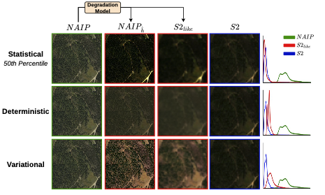
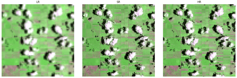
SEN2NAIP is a large-scale dataset designed to support super-resolution in remote sensing by pairing low-resolution Sentinel-2 images with high-resolution NAIP imagery. It includes 2,851 original LR-HR pairs and over 35,000 synthetic pairs generated via a custom degradation model, enabling the development of models to enhance Sentinel-2 spatial resolution.
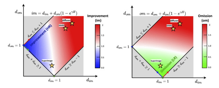
In recent years, increased attention has been given to image super-resolution (SR) techniques in remote sensing, which are aimed at reconstructing high-resolution imagery from low-resolution sources. To address ongoing challenges in evaluation, OpenSR-test has been presented as a comprehensive benchmark specifically designed for assessing SR in remote sensing, featuring tailored quality metrics and curated cross-sensor datasets.
IEEE Journal of Applied Remote Sensing and Photogrammetry
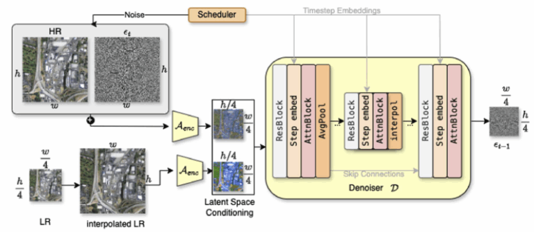
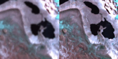
A computationally efficient latent diffusion model is proposed for super-resolving Sentinel-2 imagery from 10 m to 2.5 m, with both visible and NIR bands incorporated and conditioned on the input to preserve spectral fidelity. Unlike previous approaches, pixel-level uncertainty maps are generated, allowing the reliability of the enhanced imagery to be assessed for critical remote sensing tasks.
IEEE Journal of Applied Remote Sensing and Photogrammetry
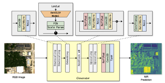
NIR-GAN is introduced as a conditional GAN designed to synthesize near-infrared (NIR) imagery from RGB inputs through image-to-image translation, incorporating SatCLIP-based location embeddings and task-specific loss functions. Realistic NIR data is generated to address the absence of NIR bands in many remote sensing datasets, enabling the creation of multispectral training data for downstream applications.
Remote-Sensing-SRGAN is a research-grade GAN framework for super-resolution of Sentinel-2 and other remote-sensing imagery. It supports arbitrary band counts, configurable generator/discriminator designs, scalable depth/width, and a modular loss system designed for stable GAN training on EO data.
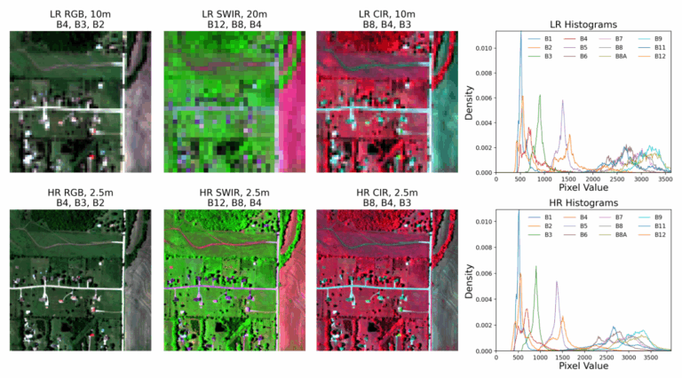
A new framework, SEN2SR, was proposed to super-resolve Sentinel-2 images while preserving spectral and spatial consistency, using harmonized synthetic training data and a low-frequency constraint to minimize artifacts. Superior performance in resolution enhancement and downstream tasks was achieved and evaluated across various deep learning architectures with the aid of Explainable AI techniques.
SEN2NEON introduces a physically grounded benchmark for Sentinel-2 super-resolution by pairing real Sentinel-2 observations with harmonized 2.5 m AVIRIS-NG reference imagery across nearly all multispectral bands. By avoiding synthetic degradation and emphasizing radiometric and spatial consistency, it enables more reliable quantitative evaluation of super-resolution models for Earth observation.
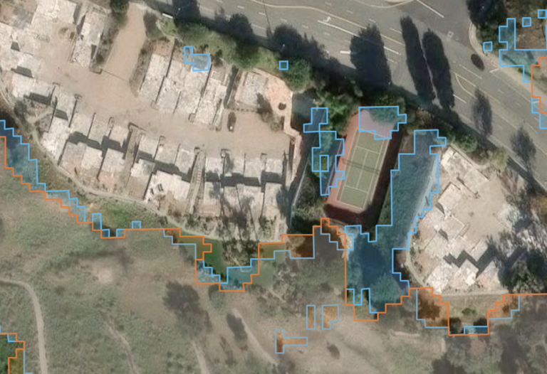
How trustworthy is super-resolved Sentinel-2 imagery for downstream geospatial analysis? Our new study evaluates five super-resolution approaches on flood and wildfire mapping, showing how spectral fidelity, spatial detail, and boundary behaviour trade off in real-world Earth observation workflows.