New Publication: Evaluating Sentinel-2 Super-Resolution for Geospatial Information Extraction

Evaluating Sentinel-2 Super-Resolution for Geospatial Information Extraction

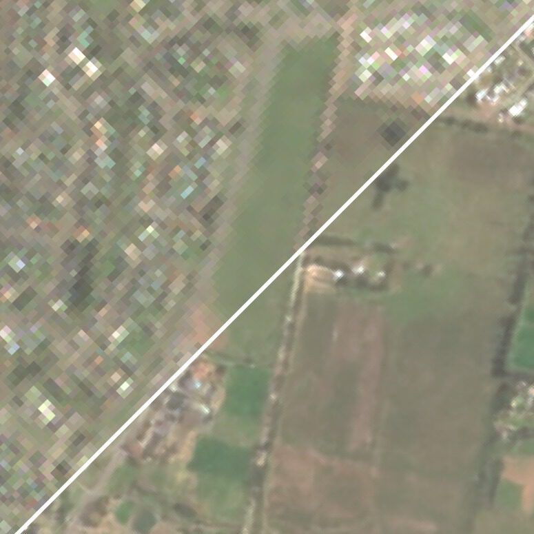
Super-resolution (SR) methods for Earth observation are commonly evaluated using reconstruction or perceptual image-quality metrics. For many geospatial applications, however, spatial sharpness alone is not sufficient. Index-based workflows depend on physically meaningful relationships between spectral bands, and spectral distortions introduced by SR can propagate directly into the resulting thematic products.

In our new publication in MDPI Geomatics, “Evaluating Sentinel-2 Super-Resolution for Geospatial Information Extraction: A Spectral and Thematic Assessment,” we evaluate this problem using two real hazard-mapping cases: the 2024 Valencia flood and the 2025 Palisades wildfire.
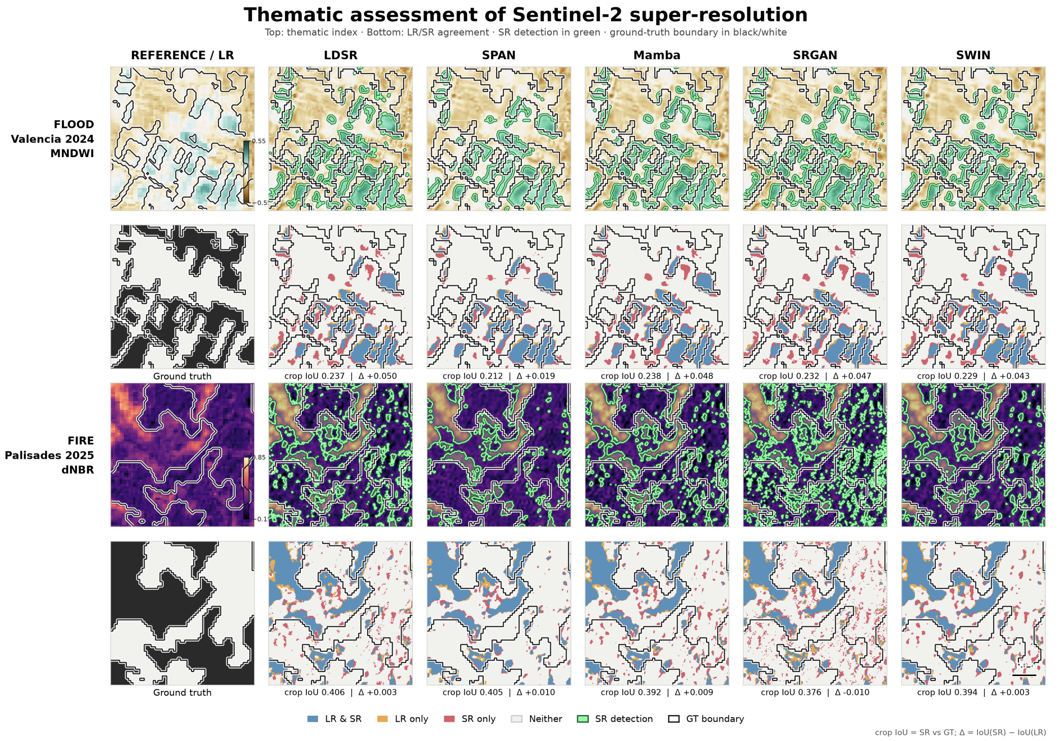
Thematic assessment of Sentinel-2 super-resolution for flood and burn-scar mapping
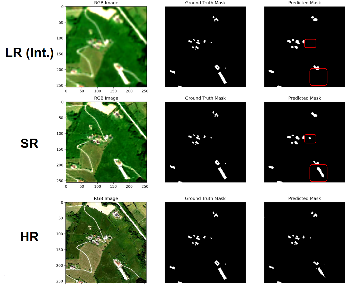
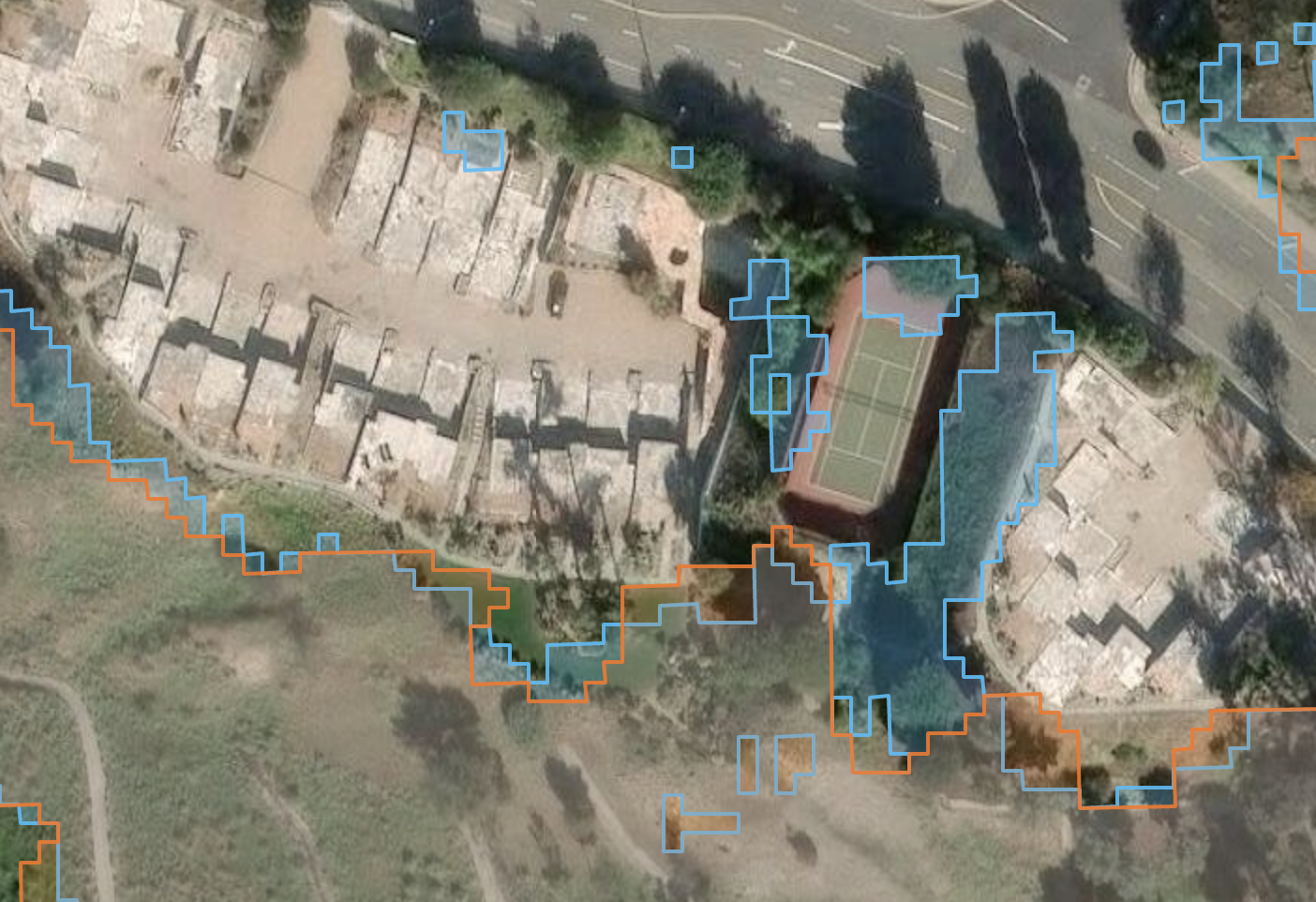
Image 1: Comparison of MNDWI flood-water and dNBR burn-scar mapping using the native Sentinel-2 input and five super-resolution configurations.

Experimental setup

We compare five model families for 4× super-resolution of the native 10 m Sentinel-2 RGB–NIR bands: LDSR-S2, OpenSR-SRGAN, SPAN, Mamba, and SWIN. Each model reconstructs bands B2, B3, B4, and B8 from 10 m to 2.5 m.

The resulting RGB–NIR products are then used within SEN2SR to reconstruct the six native 20 m red-edge and SWIR bands. This produces a ten-band Sentinel-2 product at a common spatial resolution of 2.5 m for every configuration.

All models are used without event-specific training or fine-tuning. The evaluation therefore measures how pretrained SR systems behave when applied to spectral conditions associated with flooding, burned vegetation, char, exposed soil, and other hazard-related surface changes.
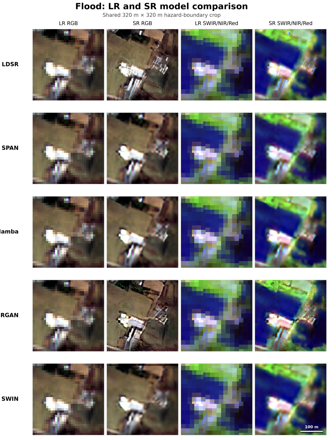
Super-resolution comparison for the 2024 Valencia flood
Image 2: RGB and SWIR–NIR–red reconstructions for the 2024 Valencia flood.
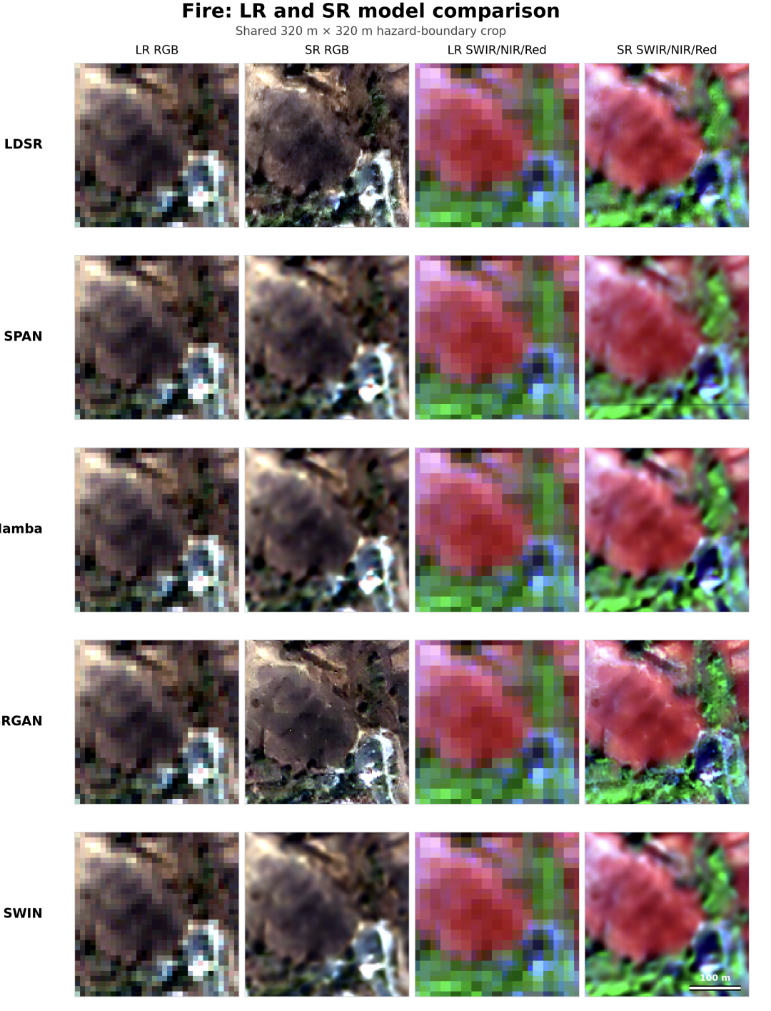
Super-resolution comparison for the 2025 Palisades wildfire
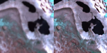
Image 3: RGB and SWIR–NIR–red reconstructions for the 2025 Palisades wildfire.

Spectral consistency and spatial synthesis

We evaluate the SR products after aggregation back to the native Sentinel-2 grid using conventional reconstruction metrics and the OpenSR consistency and synthesis metrics. The results show a clear trade-off between preserving the original Sentinel-2 measurements and introducing additional high-frequency spatial content.

SWIN achieves the strongest native-grid reconstruction and spectral consistency among the learned models, but also has the lowest synthesis score. SRGAN shows the opposite behaviour: it introduces the most high-frequency content, but also produces larger radiometric and spectral deviations. SPAN, Mamba, and LDSR-S2 occupy different positions between these two extremes.

This result is important for downstream applications: a stronger spatial response does not necessarily imply a more faithful reconstruction of the underlying Sentinel-2 observation.

Flood and burn-scar mapping

We evaluate the reconstructed imagery using two physically interpretable spectral indices. Flood water is detected using MNDWI, based on the green and SWIR bands, while burn-scar mapping uses dNBR, derived from changes in NIR and SWIR reflectance between pre- and post-fire acquisitions.

For the Valencia flood, all learned configurations slightly improve the full-region agreement relative to bilinear interpolation. LDSR-S2 gives the highest full-region flood F1-score, increasing it from 0.085 to 0.091.

For the Palisades fire, SWIN provides the strongest learned-model full-region agreement, with an F1-score of 0.884 and an IoU of 0.792. The model ranking therefore depends strongly on the downstream task and evaluation criterion.

Most changes occur close to hazard boundaries

The largest effects of SR occur in the vicinity of mapped flood and fire boundaries. For flood mapping, the learned models increase edge-region detections by approximately 20–38%. Edge recall, F1-score, and IoU generally increase, but this is accompanied by a reduction in edge precision.

The same trade-off is visible in the fire case. SR can move mixed boundary pixels across the spectral-index decision threshold, increasing sensitivity to spatial structure near the event boundary while also introducing additional detections or boundary fragments.
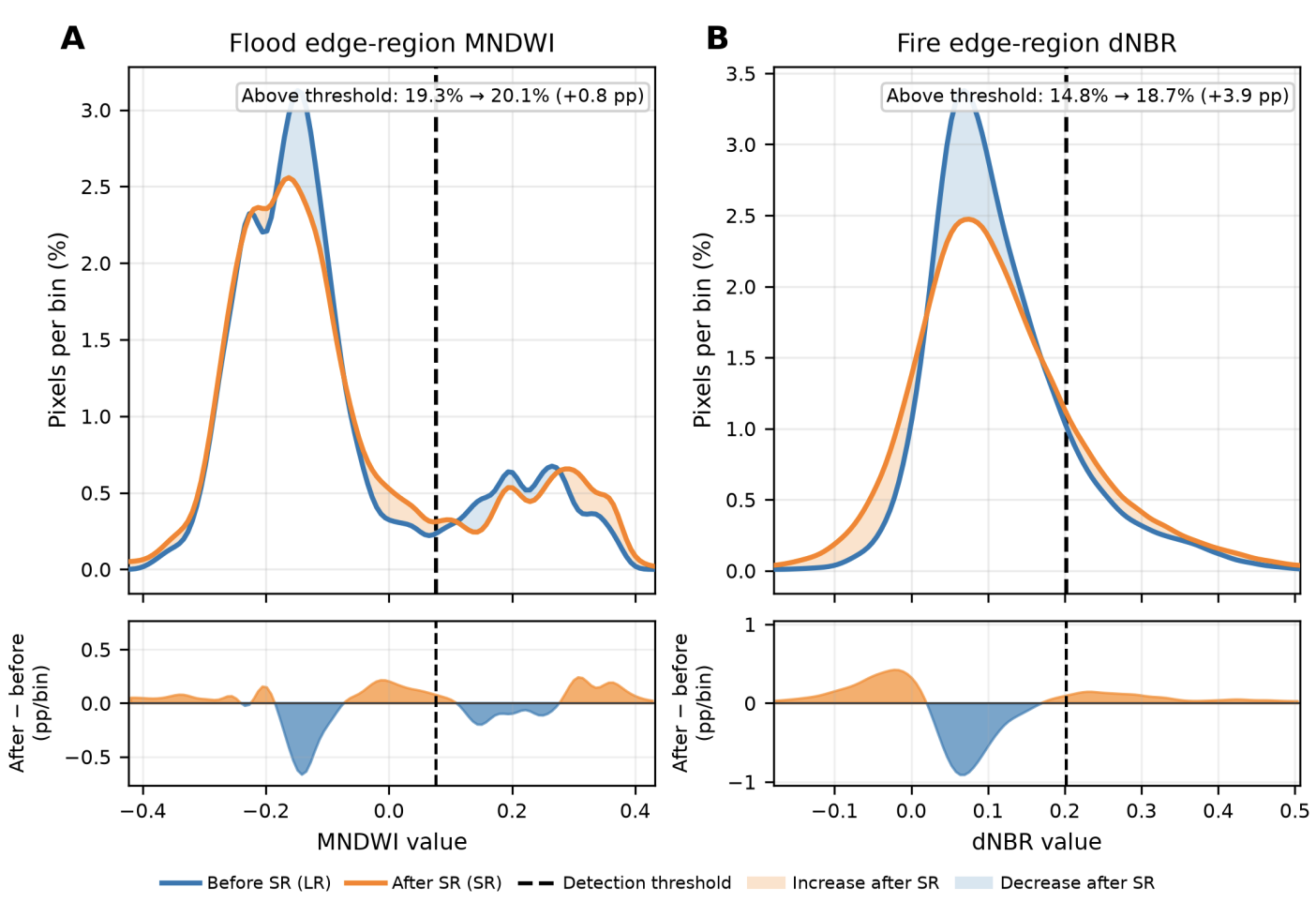
MNDWI and dNBR distributions in hazard boundary regions before and after super-resolution
Image 4: Edge-region MNDWI and dNBR distributions before and after super-resolution. Changes in the index distributions move some mixed pixels across the detection threshold.

Evaluating SR by fitness for use

No single model performs best across all criteria. SWIN provides the strongest native-grid spectral consistency and fire-task agreement, LDSR-S2 performs best for several flood and edge metrics, SPAN provides strong spatial consistency, Mamba achieves the lowest learned-model symmetric flood-boundary distance, and SRGAN produces the strongest high-frequency synthesis and edge activation at the cost of larger spectral deviations.

These results highlight the need to evaluate Earth-observation super-resolution beyond visual quality alone. For downstream geospatial applications, the relevant question is not only whether SR introduces additional spatial structure, but whether that structure remains consistent with the original spectral measurements and improves the derived thematic product.

The complete workflow, data, and generated maps are openly available.

Read the publication  |  Code and data

Explore the interactive results

The super-resolution outputs, spectral-index maps, and model comparisons for both case studies can be explored interactively below.
Open the interactive results in a new tab

Recent Posts

New Publication: Evaluating Sentinel-2 Super-Resolution for Geospatial Information Extraction

How trustworthy is super-resolved Sentinel-2 imagery for downstream geospatial analysis? Our new study evaluates five super-resolution approaches on flood and wildfire mapping, showing how spectral fidelity, spatial detail, and boundary behaviour trade off in real-world Earth observation workflows.

New Publication: SEN2NEON – Multispectral SR Validation Dataset

We have published SEN2NEON, an opend ataset for all-band validation of Sentinel-2 Super-Resolution!

The New OpenSR WebGIS Viewer: Exploring Europe at 2.5m

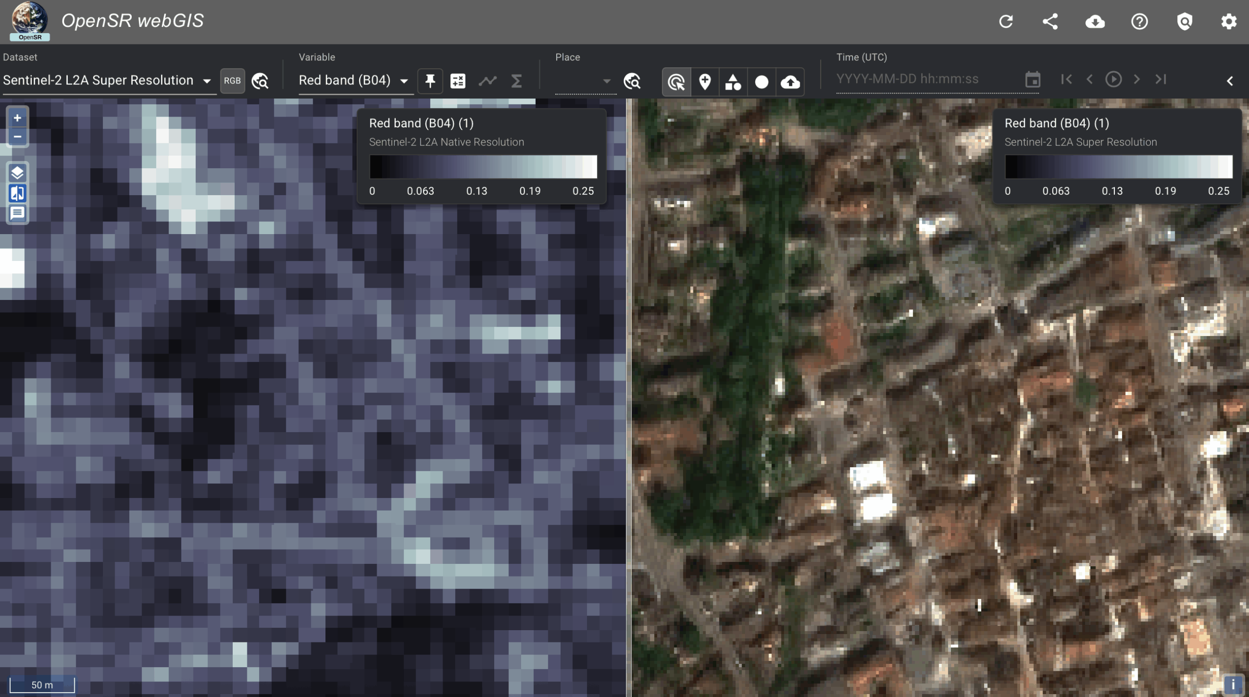
Explore our new WebGIS viewer showcasing a Europe-scale 2.5 m super-resolved Sentinel-2 data cube generated with LDSR-S2 and directly comparable to the native 10 m imagery.

OpenSR-SRGAN – Modular Framework for Multispectral SR (Code and Publication)

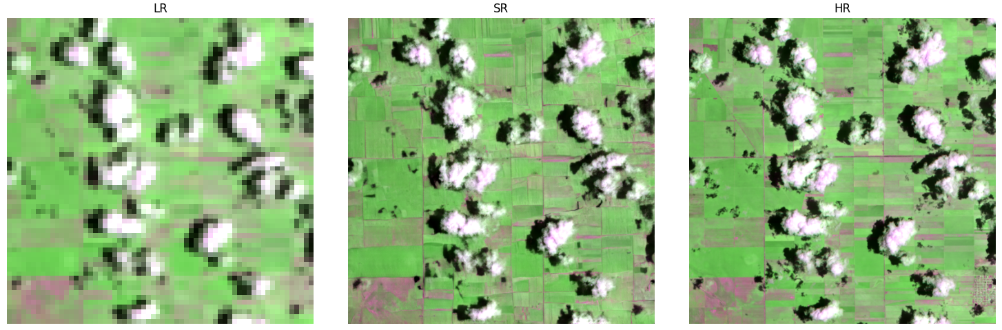
OpenSR-SRGAN is our new open-source framework that makes GAN-based super-resolution easy, modular, and fully reproducible for multispectral satellite data. It lets researchers swap architectures, losses, and training strategies through simple configuration files—no code changes needed.

SEN2SR Integration in ArcGIS!

The ESRI Analytics Team has integrated our model into ArcGIS! Users can now easily and seamlessly use our models straight without coding, straight through their GIS software.

New Publication: NIR-GAN – Syntehtic NIR from RGB images

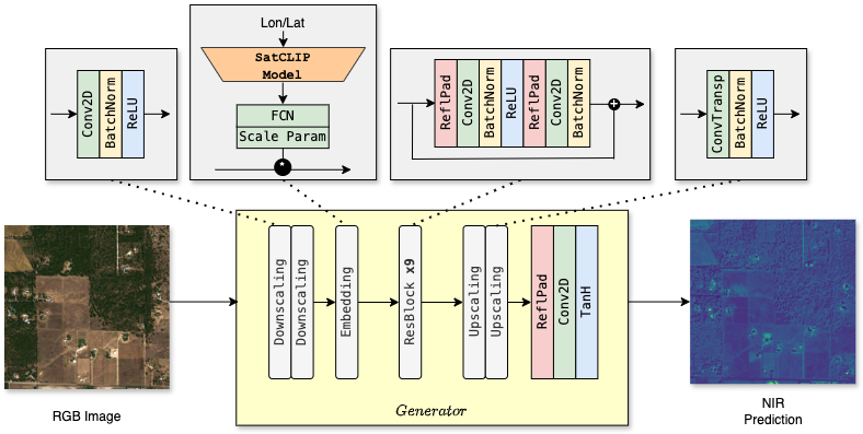
NIR-GAN: Synthesizing Near-Infrared from RGB with Location Embeddings and Task-Driven Losses We’re excited to share that our work, “Near-Infrared Band Synthesis From Earth Observation Imagery With Learned Location Embeddings and Task-Driven Loss Functions,” has been published open access by IEEE. Most remote sensing workflows depend on near-infrared (NIR) information—think NDVI/NDWI for vegetation and water—but many RGB-only archives simply don’t have it. NIR-GAN closes that gap by learning to generate a realistic NIR band directly from RGB, so practitioners can compute familiar indices and train multispectral models even when NIR isn’t available. What we built NIR-GAN (conditional GAN): An image-to-image model ...

OpenSR at the 4th IADF School: Luis and César Lead Sessions on EO Super-Resolution

Luis Gómez Chova and César Aybar represented OpenSR at the 4th IADF School in Benevento, delivering sessions on super resolution and EO machine learning.

No-Code SR Demo is now live!

This demo, aimed at non-technical users, allows you to enter your coordinates and create a super-resolution product on your custom Sentinel-2 acquisition. Immediately judge wether SR can be useful for you application!

OpenSR Team @Living Planet Symposium

The OpenSR team joined ESA’s Living Planet Symposium 2025 to present our latest advances in Sentinel-2 super-resolution, dataset standards, and workflows. From latent diffusion models to FAIR-compliant data access with TACO, our tools aim to make high-resolution Earth observation more accessible and actionable.

New Release: OpenSR-UseCases Package

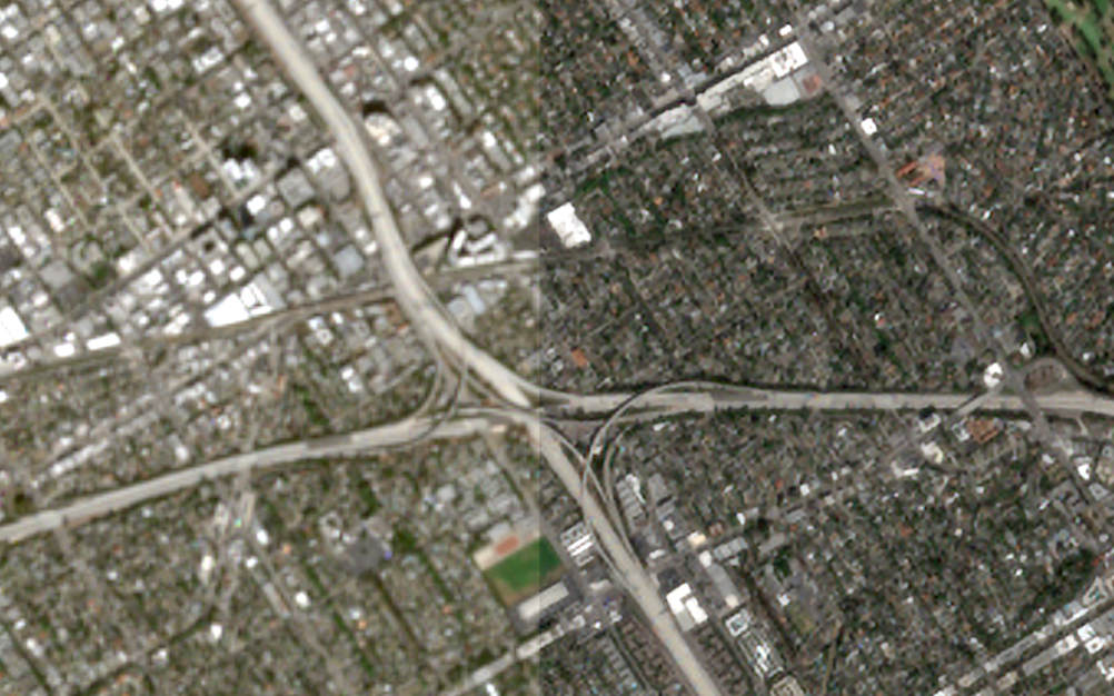
A lightweight validation toolkit to benchmark segmentation performance across low-, super-, and high-resolution imagery. Quantifies how well super-resolution models improve object detection and segmentation accuracy in real-world tasks. Ideal for researchers who want to go beyond visual inspection and measure actual downstream performance gains.

New Preprint: A Radiometrically and Spatially Consistent Super-Resolution Framework for Sentinel-2

We’ve published a new preprint presenting SEN2SR, a deep learning framework for super-resolving Sentinel-2 imagery with radiometric and spatial fidelity. The model leverages harmonized synthetic data, hard constraints, and xAI tools to achieve artifact-free enhancements at 2.5 m resolution.

RGB-NIR Latent Diffusion Super-Resolution Model Released!

Our Latent diffusion model, including weights, for the RGB-NIR bands of Sentinel-2 has been released.

New Publication: LDSR-S2 Model Paper

Our diffusion-based super-resolution model for Sentinel-2 imagery has been published in IEEE JSTARS! The open-access paper introduces a latent diffusion approach with pixelwise uncertainty maps—pushing the boundaries of trustworthy generative modeling in Earth observation.

SEN2NAIP v2.0 Released — A Major Boost for Sentinel-2 Super-Resolution

We’ve released SEN2NAIP v2.0, a large-scale dataset designed for training and validating super-resolution models on Sentinel-2 imagery. The dataset includes thousands of real and synthetic HR-LR image pairs, making it a cornerstone for future SR research in Earth Observation.

New Publication: SEN2NAIP published in ‘Scientific Data’

The dataset paper has been published in 'Scientific Data'.